Developing and Hosting a Property Tax Application
This project utilized a Tarrant County parcels dataset from 2020 as a foundation for a new feature class that included calculated property tax for each parcel with data from 2021. Using ArcGIS Pro, a copy of the existing feature class was created and its joins removed to create a template with just polygons of the parcels. Next, Python was used to create a new feature class utilizing the original polygon information and add it to the geodatabase (code is here). A subset of the 2021 data was then adjusted to turn numeric city codes into its associated city name, to create a property tax column with the corresponding property tax and to transform addresses by splitting them and adding each address element into specific address columns types for an easier lookup process (code is here).
Next, the 2020 property table that came in the original downloaded map package was truncated and the transformed 2021 data was added to the table. The a parcel ID number that connected the original 2020 data was re-added to connect the 2021 data to the existing polygon parcels and published as a map service.

Publishing a map service with the cleaned 2021 Tarrant County data.
A t2.medium EC2 instance had been created on Amazon Web Services (AWS) to host the property tax map and an elastic IP and security groups were set up. ArcGIS Server Cloud Builder was used to create and maintain the ArcGIS server and a domain was purchased. There originally was difficulty getting the domain activated with the domain registrar, so tech support was contacted and a temporary outage on their end was rectified, resulting in the domain purchase working properly.
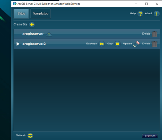
ArcGIS Server Cloud Builder displaying the running ‘arcgisserver2’.

Purchasing a domain and working through troubleshooting procedures.
An SSL (Secure Sockets Layer) certificate was created and bound to the domain via IIS (Internet Information Services) on the EC2 virtual machine. The website now has a closed lock icon with a “connection is secure” to indicate the site’s security certification.

The SSL certification informs end users that the website is secure.
The map was then uploaded to the server where it would be available for a web application to pull information from.
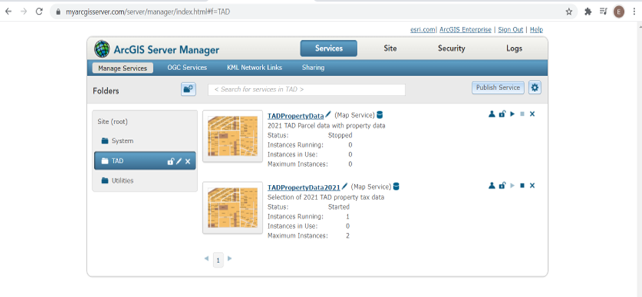
TAD property tax maps on ArcGIS Server Manager.

The final step was to create a property tax app using ArcGIS Web AppBuilder and the hosted map data. When a parcel was selected, the corresponding 2021 data associated with it appeared in a pop-up.
A selected parcel in Tarrant County and its relevant popup containing parcel information on a web application.